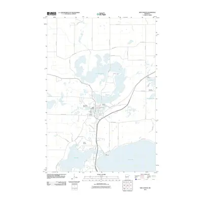
2010 Map of New London
USGS Topo · Published 2010About this map
New London serves as the focal point for this lake-rich region of Kandiyohi County, where the Middle Fork Crow River connects a chain of significant water bodies. The settlement's infrastructure is prominently marked by the New London Dam and the New London Post Office, while the New London National Fish Hatchery highlights the local focus on aquatic resources. To the south, the Nest Lake Dam regulates the transition between Nest Lake and the northern reaches of Green Lake.
Find a feature on this map
50 named features on this map. Tap any name to fly to it.
Don’t see what you’re looking for? This feature index may not catch every label — zoom into the map to look around manually.
Map Details
Editions of this 2010 New London Map
This is the sole edition of this map. No revisions or reprints were ever made.
Other maps of this area

1953 · Saint Cloud
USGS Topo · 1:250,000

1956 · Atwater
USGS Topo · 1:62,500

1957 · Saint Cloud
USGS Topo · 1:250,000

1958 · Saint Cloud
USGS Topo · 1:250,000

1958 · Solomon Lake
USGS Topo · 1:24,000

1967 · Mount Tom
USGS Topo · 1:24,000

1967 · Belgrade
USGS Topo · 1:24,000
1967 · Georgeville
USGS Topo · 1:24,000

1967 · Hawick
USGS Topo · 1:24,000
1967 · Lake Henry
USGS Topo · 1:24,000