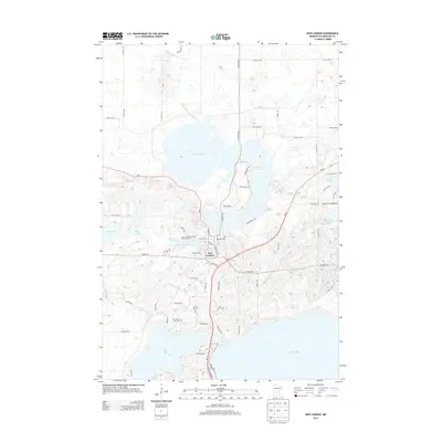
2013 Map of New London
USGS Topo · Published 2013About this map
New London is centered within a complex landscape of glacial lakes and river bends in Kandiyohi County. The Middle Fork Crow River snakes through the terrain, feeding into and out of Lake Monongalia and the local Mill Pond. This 2013 topographic study highlights the intersection of natural hydrology and community infrastructure, including the New London National Fish Hatchery situated just north of the town center.
Find a feature on this map
60 named features on this map. Tap any name to fly to it.
Don’t see what you’re looking for? This feature index may not catch every label — zoom into the map to look around manually.
Map Details
Editions of this 2013 New London Map
This is the sole edition of this map. No revisions or reprints were ever made.
Other maps of this area

1953 · Saint Cloud
USGS Topo · 1:250,000

1956 · Atwater
USGS Topo · 1:62,500

1957 · Saint Cloud
USGS Topo · 1:250,000

1958 · Saint Cloud
USGS Topo · 1:250,000

1958 · Solomon Lake
USGS Topo · 1:24,000

1967 · Mount Tom
USGS Topo · 1:24,000

1967 · Belgrade
USGS Topo · 1:24,000
1967 · Georgeville
USGS Topo · 1:24,000

1967 · Hawick
USGS Topo · 1:24,000
1967 · Lake Henry
USGS Topo · 1:24,000