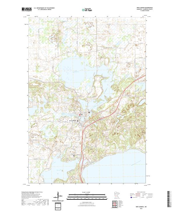
2022 Map of New London
USGS Topo · Published 2022About this map
The village of New London sits at the heart of this central Minnesota landscape, where the Middle Fork Crow River connects a chain of large water bodies including Lake Monongalia and Nest Lake. This modern survey reveals the area's intricate hydrologic network and the recreational corridors that have come to define it, such as the Glacial Lakes State Trl which follows a former rail alignment. The terrain is part of the broader Bonanza Valley, a region shaped by glacial activity that left behind numerous smaller potholes and marshes north of the main lakes.
Find a feature on this map
55 named features on this map. Tap any name to fly to it.
Don’t see what you’re looking for? This feature index may not catch every label — zoom into the map to look around manually.
Map Details
Editions of this 2022 New London Map
This is the sole edition of this map. No revisions or reprints were ever made.
Other maps of this area

1953 · Saint Cloud
USGS Topo · 1:250,000

1956 · Atwater
USGS Topo · 1:62,500

1957 · Saint Cloud
USGS Topo · 1:250,000

1958 · Saint Cloud
USGS Topo · 1:250,000

1958 · Solomon Lake
USGS Topo · 1:24,000

1967 · Mount Tom
USGS Topo · 1:24,000

1967 · Belgrade
USGS Topo · 1:24,000
1967 · Georgeville
USGS Topo · 1:24,000

1967 · Hawick
USGS Topo · 1:24,000
1967 · Lake Henry
USGS Topo · 1:24,000