
1970 Map of New Lynn
USGS Topo · Published 1971About this map
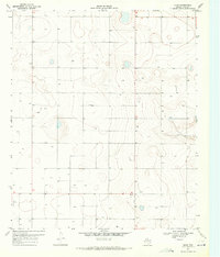
Tahoka Lake dominates the northwest corner of this high plains landscape, its saline waters and depressions standing in contrast to the surrounding agricultural grid. Photogrammetric methods from 1968 reveal a territory defined by resource extraction and groundwater management, with numerous Well sites and clusters of Wells dotting the Llano Estacado. The small settlements of New Lynn and Bartley serve as local centers for the region's ranching and farming operations, while a central Substation indicates the developing infrastructure required to power the increasing number of pumps across the county. This 1970 field-checked survey preserves the exact placement of fence lines and section corners, offering a detailed view of West Texas land division and water use before later industrial changes shifted the rural character of Lynn County.
Find a feature on this map
6 named features on this map. Tap any name to fly to it.
Don’t see what you’re looking for? This feature index may not catch every label — zoom into the map to look around manually.
Map Details
Editions of this 1970 New Lynn Map
This is the sole edition of this map. No revisions or reprints were ever made.
Other maps of this area

1954 · Lubbock
USGS Topo · 1:250,000

1957 · New Home
USGS Topo · 1:62,500

1965 · Southland
USGS Topo · 1:24,000

1965 · Wilson
USGS Topo · 1:24,000

1969 · Skeen Lake
USGS Topo · 1:24,000

1969 · Tahoka
USGS Topo · 1:24,000

1969 · Grassland SE
USGS Topo · 1:24,000
1970 · Draw
USGS Topo · 1:24,000

1970 · Grassland
USGS Topo · 1:24,000
1976 · New Home SE
USGS Topo · 1:24,000