
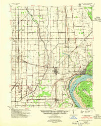
1954 Map of New Madrid
USGS Topo · Published 1955About this map
New Madrid sits at the apex of a dramatic bend in the Mississippi River, serving as a focal point for this mid-1950s survey of southeastern Missouri. The landscape is defined by the rigid geometry of drainage ditches and section lines, a testament to the intensive land reclamation of the Bootheel region. Major rail corridors including the St Louis Southwestern Ry and the Missouri Pacific RR connect agricultural hubs like Lilbourn, Marston, and Kewanee.
Find a feature on this map
64 named features on this map. Tap any name to fly to it.
Don’t see what you’re looking for? This feature index may not catch every label — zoom into the map to look around manually.
Map Details
Editions of this 1954 New Madrid Map
2 editions found
Other maps of this area

1925 · Reelfoot Lake
USGS Topo · 1:62,500

1931 · Sikeston
USGS Topo · 1:62,500

1934 · Bloomfield
USGS Topo · 1:62,500

1934 · Sikeston
USGS Topo · 1:62,500

1939 · Bloomfield
USGS Topo · 1:62,500

1939 · Sikeston
USGS Topo · 1:62,500

1939 · Reelfoot Lake
USGS Topo · 1:62,500

1939 · Charleston
USGS Topo · 1:62,500

1939 · Portageville
USGS Topo · 1:62,500

1939 · New Madrid
USGS Topo · 1:62,500