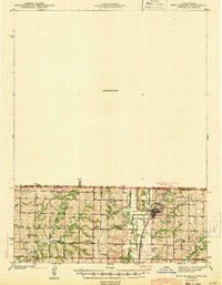
1943 Map of New Market
USGS Topo · Published 1943About this map
The town of Hopkins serves as a focal point on this border-straddling survey, where the Chicago Burlington and Quincy railroad tracks run parallel to the Hundred and Two River. The map depicts a densely settled rural landscape defined by small-scale community structures, including numerous schools such as Lone Elm Sch and Hickory Grove Sch, and several family-named burial grounds like Burch Cem and Morehouse Cem.
Find a feature on this map
40 named features on this map. Tap any name to fly to it.
Don’t see what you’re looking for? This feature index may not catch every label — zoom into the map to look around manually.
Map Details
Editions of this 1943 New Market Map
2 editions found

Other maps of this area

1939 · Skidmore
USGS Topo · 1:62,500

1940 · Bedford
USGS Topo · 1:62,500

1940 · Coin
USGS Topo · 1:62,500

1940 · New Market
USGS Topo · 1:62,500

1940 · Parnell
USGS Topo · 1:62,500

1941 · Skidmore
USGS Topo · 1:62,500

1942 · Skidmore
USGS Topo · 1:62,500

1943 · Bedford
USGS Topo · 1:62,500

1943 · Parnell
USGS Topo · 1:62,500

1943 · Coin
USGS Topo · 1:62,500