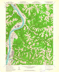
1960 Map of New Martinsville
USGS Topo · Published 1962About this map
The Ohio River corridor serves as the industrial and transportation backbone for this river valley, where the Baltimore and Ohio and Pennsylvania railroads hug the banks. In the north, the Natrium Chemical Plant and its adjacent Settling Pond at Natrium reflect the mid-century industrial expansion, while the town of New Martinsville anchoring the south shows a detailed grid of residential streets, the County Infirmary, and a Drive-in Theater. Across the water, the town of Hannibal and the landing for the Ferry at Duffy highlight the cross-river connections of the era.
Find a feature on this map
90 named features on this map. Tap any name to fly to it.
Don’t see what you’re looking for? This feature index may not catch every label — zoom into the map to look around manually.
Map Details
Editions of this 1960 New Martinsville Map
4 editions found
Other maps of this area

1903 · Littleton
USGS Topo · 1:62,500

1904 · Cameron
USGS Topo · 1:62,500

1905 · Littleton
USGS Topo · 1:62,500

1905 · Clarington
USGS Topo · 1:62,500

1906 · New Martinsville
USGS Topo · 1:62,500

1924 · New Martinsville
USGS Topo · 1:62,500

1924 · Littleton
USGS Topo · 1:62,500

1926 · Littleton
USGS Topo · 1:62,500

1926 · New Martinsville
USGS Topo · 1:62,500

1935 · Cameron
USGS Topo · 1:62,500