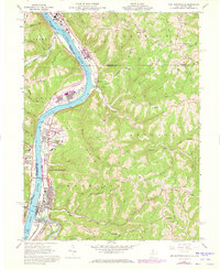
1960 Map of New Martinsville
USGS Topo · Published 1973About this map
New Martinsville and its surrounding riverfront communities are captured during a period of industrial activity and transportation shifts along the Ohio River. The map documents a critical corridor where the Baltimore and Ohio and Penn Central railroads parallel the water, supporting local industries like the gas wells and oil wells scattered across the dissected plateau of Yoho Ridge and Highland Ridge. The presence of the Toll Br and a Ferry near Brooklyn highlights the continued importance of cross-river transit between West Virginia and Ohio.
Find a feature on this map
80 named features on this map. Tap any name to fly to it.
Don’t see what you’re looking for? This feature index may not catch every label — zoom into the map to look around manually.
Map Details
Editions of this 1960 New Martinsville Map
4 editions found
Other maps of this area

1903 · Littleton
USGS Topo · 1:62,500

1904 · Cameron
USGS Topo · 1:62,500

1905 · Littleton
USGS Topo · 1:62,500

1905 · Clarington
USGS Topo · 1:62,500

1906 · New Martinsville
USGS Topo · 1:62,500

1924 · New Martinsville
USGS Topo · 1:62,500

1924 · Littleton
USGS Topo · 1:62,500

1926 · Littleton
USGS Topo · 1:62,500

1926 · New Martinsville
USGS Topo · 1:62,500

1935 · Cameron
USGS Topo · 1:62,500