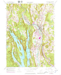
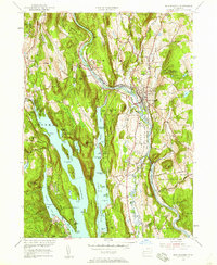
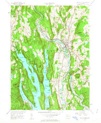
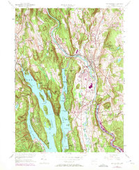
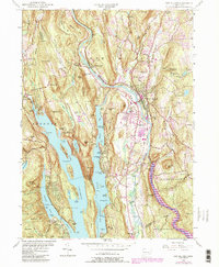
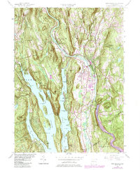
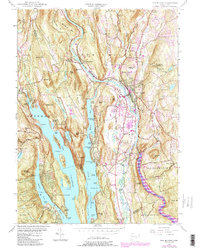
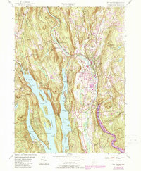
1955 Map of New Milford
USGS Topo · Published 1979About this map
The Housatonic River carves a deep valley through Litchfield County, anchoring the town of New Milford as it appeared in the mid-20th century. This area shows a landscape defined by the transition from industrial water power to recreational development, particularly around the northern reaches of Candlewood Lake. Evidence of early industry remains at The Lime Kiln and Haviland Millpond, while the rail corridor of the Penn Central tracks follows the river’s winding course past Boardman Bridge.
Find a feature on this map
108 named features on this map. Tap any name to fly to it.
Don’t see what you’re looking for? This feature index may not catch every label — zoom into the map to look around manually.
Map Details
Editions of this 1955 New Milford Map
9 editions found

Other maps of this area

1892 · Danbury
USGS Topo · 1:62,500

1892 · New Milford
USGS Topo · 1:62,500

1892 · Carmel
USGS Topo · 1:62,500

1893 · Carmel
USGS Topo · 1:62,500

1893 · New Milford
USGS Topo · 1:62,500

1893 · Clove
USGS Topo · 1:62,500

1894 · Clove
USGS Topo · 1:62,500

1894 · Carmel
USGS Topo · 1:62,500

1898 · Clove
USGS Topo · 1:62,500

1901 · Clove
USGS Topo · 1:62,500