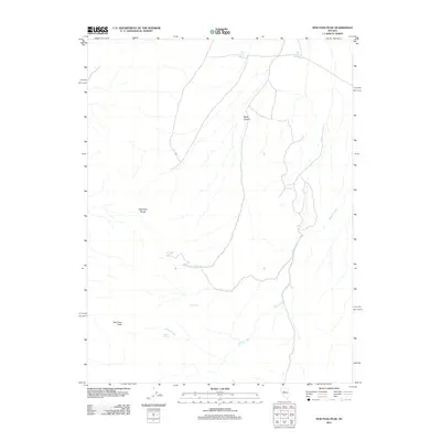
2011 Map of New Pass Peak
USGS Topo · Published 2011About this map
New Pass Peak stands as the primary landmark in this corner of Churchill County, anchoring the southern portion of the New Pass Range. The landscape is defined by the high desert drainage patterns of Gilbert Creek, which meanders through the eastern foothills. This 2011 survey documents a series of critical water sources essential to the arid environment, including Little Antelope Spring and Big Antelope Spring in the north, and Deer Spring located centrally within the range. The presence of these named springs and the seasonal flow of Water Canyon suggest the historic and contemporary importance of water management in this high-altitude basin. The map tracks the winding primitive routes that follow the natural topography of the canyons, providing a detailed look at the corridor between the peaks and the surrounding Great Basin desert.
Find a feature on this map
9 named features on this map. Tap any name to fly to it.
Don’t see what you’re looking for? This feature index may not catch every label — zoom into the map to look around manually.
Map Details
Editions of this 2011 New Pass Peak Map
This is the sole edition of this map. No revisions or reprints were ever made.
Other maps of this area

1955 · Millett
USGS Topo · 1:250,000

1959 · Millett
USGS Topo · 1:250,000

1966 · Shoshone Meadows
USGS Topo · 1:62,500

1966 · Edwards Creek Valley
USGS Topo · 1:62,500

1969 · Gilbert Creek SE
USGS Topo · 1:24,000

1969 · Mount Airy
USGS Topo · 1:24,000

1969 · Gilbert Creek SW
USGS Topo · 1:24,000

1969 · Mount Airy NW
USGS Topo · 1:24,000

1969 · Mount Airy NE
USGS Topo · 1:24,000

1969 · Mount Airy Mesa
USGS Topo · 1:24,000