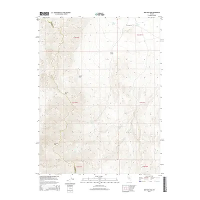
2014 Map of New Pass Peak
USGS Topo · Published 2014About this map
New Pass Peak stands as the primary landmark in this high-desert basin and range landscape on the border of Churchill and Lander Counties. The terrain is defined by the New Pass Range, which divides the watershed between Antelope Valley and the drainage systems to the east. Water sources are critical features in this arid environment, evidenced by a string of isolated points such as Little Antelope Spring, Big Antelope Spring, and Deer Spring. The presence of Water Canyon and its associated Water Canyon Spring suggests a topography shaped by intermittent flow, while Gilbert Cr provides a primary channel through the southern reaches of the quadrangle. Transportation is limited to a few primitive routes, most notably Antelope Valley Rd, which skirts the northern foothills.
Find a feature on this map
18 named features on this map. Tap any name to fly to it.
Don’t see what you’re looking for? This feature index may not catch every label — zoom into the map to look around manually.
Map Details
Editions of this 2014 New Pass Peak Map
This is the sole edition of this map. No revisions or reprints were ever made.
Other maps of this area

1955 · Millett
USGS Topo · 1:250,000

1959 · Millett
USGS Topo · 1:250,000

1966 · Shoshone Meadows
USGS Topo · 1:62,500

1966 · Edwards Creek Valley
USGS Topo · 1:62,500

1969 · Gilbert Creek SE
USGS Topo · 1:24,000

1969 · Mount Airy
USGS Topo · 1:24,000

1969 · Gilbert Creek SW
USGS Topo · 1:24,000

1969 · Mount Airy NW
USGS Topo · 1:24,000

1969 · Mount Airy NE
USGS Topo · 1:24,000

1969 · Mount Airy Mesa
USGS Topo · 1:24,000