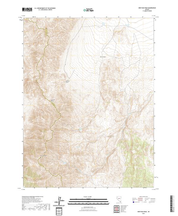
2021 Map of New Pass Peak
USGS Topo · Published 2021About this map
New Pass Peak and the New Pass Range dominate this portion of the Great Basin along the border of Churchill and Lander Counties. This high-desert landscape is defined by its critical water sources, which dictated movement and land use throughout the region. The map reveals a network of vital points including Little Antelope Spring, Big Antelope Spring, and Water Canyon Spring, each essential for livestock and local survival in the arid Antelope Valley. To the south, drainage systems like Gilbert Cr and landmarks such as Gilbert Spring reflect the sparse but deliberate settlement pattern of this remote Nevada interior. The topography shows the complex drainages of Water Canyon, providing a clear record of the area's natural hydrology and traditional grazing boundaries.
Find a feature on this map
18 named features on this map. Tap any name to fly to it.
Don’t see what you’re looking for? This feature index may not catch every label — zoom into the map to look around manually.
Map Details
Editions of this 2021 New Pass Peak Map
This is the sole edition of this map. No revisions or reprints were ever made.
Other maps of this area

1955 · Millett
USGS Topo · 1:250,000

1959 · Millett
USGS Topo · 1:250,000

1966 · Shoshone Meadows
USGS Topo · 1:62,500

1966 · Edwards Creek Valley
USGS Topo · 1:62,500

1969 · Gilbert Creek SE
USGS Topo · 1:24,000

1969 · Mount Airy
USGS Topo · 1:24,000

1969 · Gilbert Creek SW
USGS Topo · 1:24,000

1969 · Mount Airy NW
USGS Topo · 1:24,000

1969 · Mount Airy NE
USGS Topo · 1:24,000

1969 · Mount Airy Mesa
USGS Topo · 1:24,000