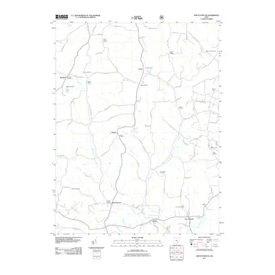
2011 Map of New Plymouth
USGS Topo · Published 2011About this map
New Plymouth and the surrounding rural landscape of Hocking County are defined by a dense network of family-named landmarks and small burial grounds. This area is characterized by the branching drainages of the West Branch Raccoon Creek and East Branch Raccoon Creek, which carve through prominent ridges like Calico Ridge, Harble Ridge, and Tick Ridge. Genealogists will find a high concentration of burial sites, including the Morris Chapel Cemetery near Morris Chapel and the Olive Branch Cemetery along Honey Fork. The settlement pattern follows the narrow valleys and hollows, such as Metz Hollow and Goat Run, where small hamlets like Ewing, Ilesboro, and Orland served as local hubs. The presence of Hidden Lake Dam and numerous named runs and forks illustrates the complex local hydrology that shaped early transportation and land use in this part of southeastern Ohio.
Find a feature on this map
82 named features on this map. Tap any name to fly to it.
Don’t see what you’re looking for? This feature index may not catch every label — zoom into the map to look around manually.
Map Details
Editions of this 2011 New Plymouth Map
This is the sole edition of this map. No revisions or reprints were ever made.
Other maps of this area

1904 · Zaleski
USGS Topo · 1:62,500

1907 · Zaleski
USGS Topo · 1:62,500

1907 · Logan
USGS Topo · 1:62,500

1907 · Lancaster
USGS Topo · 1:62,500

1909 · Lancaster
USGS Topo · 1:62,500

1909 · Logan
USGS Topo · 1:62,500

1910 · Laurelville
USGS Topo · 1:62,500

1912 · Laurelville
USGS Topo · 1:62,500

1944 · Laurelville
USGS Topo · 1:62,500

1947 · Columbus
USGS Topo · 1:250,000