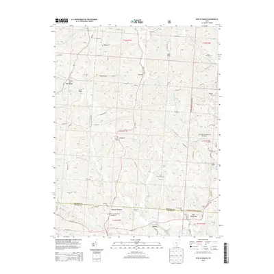
2013 Map of New Plymouth
USGS Topo · Published 2013About this map
Wayne National Forest covers much of this landscape along the Hocking and Vinton county line, where the terrain is defined by ridges like Calico Ridge and Harble Ridge. The settlement pattern centers on small rural communities such as New Plymouth and Ilesboro, connected by a network of winding roads like State Rte 56 and Oh-93. The area is notably dense with small family and community burial grounds, including Chapel Cem, Strawn Cem, and Meldrim Cem, which are often located near local watercourses like Scott Cr and Honey Fork. The southeastern portion of the map is dominated by the valleys of the W Br Raccoon Cr and E Br Raccoon Cr. This topography reflects the typical Appalachian plateau character of southeastern Ohio, where agriculture and forestry have long shaped the local economy and social geography.
Find a feature on this map
80 named features on this map. Tap any name to fly to it.
Don’t see what you’re looking for? This feature index may not catch every label — zoom into the map to look around manually.
Map Details
Editions of this 2013 New Plymouth Map
This is the sole edition of this map. No revisions or reprints were ever made.
Other maps of this area

1904 · Zaleski
USGS Topo · 1:62,500

1907 · Zaleski
USGS Topo · 1:62,500

1907 · Logan
USGS Topo · 1:62,500

1907 · Lancaster
USGS Topo · 1:62,500

1909 · Lancaster
USGS Topo · 1:62,500

1909 · Logan
USGS Topo · 1:62,500

1910 · Laurelville
USGS Topo · 1:62,500

1912 · Laurelville
USGS Topo · 1:62,500

1944 · Laurelville
USGS Topo · 1:62,500

1947 · Columbus
USGS Topo · 1:250,000