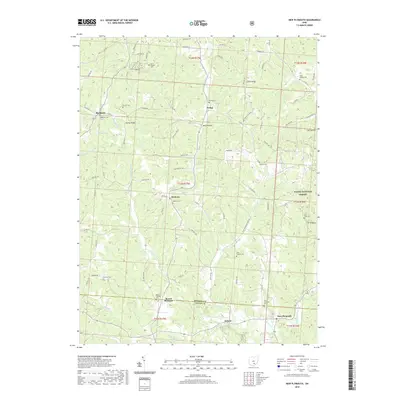
2019 Map of New Plymouth
USGS Topo · Published 2019About this map
New Plymouth and Ilesboro anchor this 2019 survey of the dissected plateaus along the Hocking and Vinton county line. The landscape is defined by the high ridges of Harble Ridge and Calico Ridge, with settlement patterns historically tied to the winding valley floors of W Br Raccoon Cr and Honey Fork. This map is particularly dense with genealogical sites, documenting numerous country burial grounds including Morris Chapel Cem, Miller Chapel Cem, and the remote Tick Ridge Cem near the Wayne National Forest boundary. The modern road network, including Co Rd 35 and Twp Hwy 293, follows the old contours of the terrain, connecting small clusters like Ewing and Blackjack while preserving the rural character of this corner of southeast Ohio.
Find a feature on this map
96 named features on this map. Tap any name to fly to it.
Don’t see what you’re looking for? This feature index may not catch every label — zoom into the map to look around manually.
Map Details
Editions of this 2019 New Plymouth Map
This is the sole edition of this map. No revisions or reprints were ever made.
Other maps of this area

1904 · Zaleski
USGS Topo · 1:62,500

1907 · Zaleski
USGS Topo · 1:62,500

1907 · Logan
USGS Topo · 1:62,500

1907 · Lancaster
USGS Topo · 1:62,500

1909 · Lancaster
USGS Topo · 1:62,500

1909 · Logan
USGS Topo · 1:62,500

1910 · Laurelville
USGS Topo · 1:62,500

1912 · Laurelville
USGS Topo · 1:62,500

1944 · Laurelville
USGS Topo · 1:62,500

1947 · Columbus
USGS Topo · 1:250,000