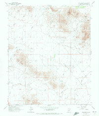
1964 Map of New River SE
USGS Topo · Published 1972About this map
Apache Peak and the surrounding high ground of the Union Hills dominate the northern landscape of this Maricopa County area, dropping down into the broad expanse of northern Paradise Valley. The 1964 survey captures a desert environment defined by water management and topography, where the drainage of Skunk Creek and Apache Wash dictates the layout of the land. Scattered water sources, critical for cattle ranching or early habitation, are meticulously recorded, including Jims Spring, Apache Spring, and various man-made catchments like Desert Lake Tank and Purcell Tank. Evidence of localized activity is found at the Gravel Pit and isolated outposts such as Bentley Well and East Joy Well. The map also traces a network of rugged transportation, notably a Jeep Trail winding through the northern peaks near Gunsight, illustrating the mid-century accessibility of this arid terrain.
Find a feature on this map
26 named features on this map. Tap any name to fly to it.
Don’t see what you’re looking for? This feature index may not catch every label — zoom into the map to look around manually.
Map Details
Editions of this 1964 New River SE Map
4 editions found
Other maps of this area

1904 · Camelback
USGS Topo · 1:62,500

1906 · Camelsback
USGS Topo · 1:62,500

1930 · Cave Creek
USGS Topo · 1:125,000

1939 · Cave Creek
USGS Topo · 1:125,000

1954 · Phoenix
USGS Topo · 1:250,000

1954 · Mesa
USGS Topo · 1:250,000

1957 · Mesa
USGS Topo · 1:250,000

1957 · Phoenix
USGS Topo · 1:250,000

1957 · Hedgpeth Hills
USGS Topo · 1:24,000

1958 · Mesa
USGS Topo · 1:250,000