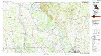
1983 Map of New Roads
USGS Topo · Published 1983About this map
The alluvial floodplains of the Mississippi River and the Atchafalaya River dominate this landscape, which reveals a complex network of bayous, oxbow lakes, and established river towns. The prominent curve of False River sits at the heart of Pointe Coupee Parish, surrounded by the namesake community of New Roads. This 1983 edition illustrates the hydraulic engineering of the region, featuring the Morganza floodway and numerous drainage bayous like Bayou des Glaises and Bayou Courtableau.
Find a feature on this map
87 named features on this map. Tap any name to fly to it.
Don’t see what you’re looking for? This feature index may not catch every label — zoom into the map to look around manually.
Map Details
Editions of this 1983 New Roads Map
2 editions found
Other maps of this area

1906 · Bayou Sara
USGS Topo · 1:125,000

1908 · Baton Rouge
USGS Topo · 1:62,500

1934 · Denham Springs
USGS Topo · 1:62,500

1935 · Osca Bayou
USGS Topo · 1:62,500

1936 · Woodville
USGS Topo · 1:62,500

1939 · St. Francisville
USGS Topo · 1:62,500

1939 · Zachary
USGS Topo · 1:62,500

1939 · Opelousas
USGS Topo · 1:62,500

1939 · Denham Springs
USGS Topo · 1:62,500

1939 · Artonish
USGS Topo · 1:62,500