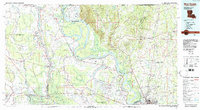
1983 Map of New Roads
USGS Topo · Published 1983About this map
The Mississippi River and Atchafalaya River dominate this 1980s landscape, illustrating a complex network of active and relic channels. The oxbow of False River defines the community of New Roads, while the expansive Raccourci Island sits within a massive bend of the Mississippi. This era shows the region's significant state presence, with the State Penitentiary located at the northern river bend, the State Industrial School for Boys to the south, and the State Hospital situated near the eastern bluffs.
Find a feature on this map
99 named features on this map. Tap any name to fly to it.
Don’t see what you’re looking for? This feature index may not catch every label — zoom into the map to look around manually.
Map Details
Editions of this 1983 New Roads Map
2 editions found
Other maps of this area

1906 · Bayou Sara
USGS Topo · 1:125,000

1908 · Baton Rouge
USGS Topo · 1:62,500

1934 · Denham Springs
USGS Topo · 1:62,500

1935 · Osca Bayou
USGS Topo · 1:62,500

1936 · Woodville
USGS Topo · 1:62,500

1939 · St. Francisville
USGS Topo · 1:62,500

1939 · Zachary
USGS Topo · 1:62,500

1939 · Opelousas
USGS Topo · 1:62,500

1939 · Denham Springs
USGS Topo · 1:62,500

1939 · Artonish
USGS Topo · 1:62,500