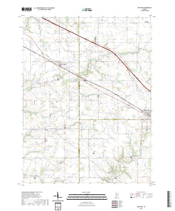
2022 Map of New Ross
USGS Topo · Published 2022About this map
New Ross sits at the intersection of Montgomery, Boone, and Hendricks counties, serving as a central point in this rural Indiana landscape. The area is defined by the winding paths of Big Raccoon Creek and its tributary, Little Raccoon Creek, which carve through the agricultural fields that dominate the terrain. This survey provides an exceptional level of detail for genealogical researchers, documenting numerous small family and community burial grounds scattered across the townships. Many of these, such as Kidd Farm Cem and Hypes Cem, are tucked away from the main thoroughfares of State Street and New Ross Road, preserving the locations of early local family settlements. To the east, the map captures the western edge of Jamestown and the small community of Advance, illustrating the network of county roads that have connected these farming communities for generations.
Find a feature on this map
89 named features on this map. Tap any name to fly to it.
Don’t see what you’re looking for? This feature index may not catch every label — zoom into the map to look around manually.
Map Details
Editions of this 2022 New Ross Map
This is the sole edition of this map. No revisions or reprints were ever made.
Other maps of this area

1953 · Lizton
USGS Topo · 1:24,000

1953 · Danville
USGS Topo · 1:24,000

1953 · Danville
USGS Topo · 1:250,000

1953 · Indianapolis
USGS Topo · 1:250,000

1955 · Danville
USGS Topo · 1:250,000

1956 · Danville
USGS Topo · 1:250,000

1956 · Indianapolis
USGS Topo · 1:250,000

1957 · Indianapolis
USGS Topo · 1:250,000

1957 · New Ross
USGS Topo · 1:24,000

1958 · Darlington
USGS Topo · 1:24,000