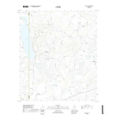
2019 Map of New Salem
USGS Topo · Published 2019About this map
New Salem sits at the heart of this landscape, surrounded by a network of springs and small creek branches that feed the major waterways of Rusk and Cherokee counties. The terrain is defined by the high ground of Quinn Mtn and the substantial waters of Lake Striker to the west. This modern topographic record captures the rural character of the region, where numerous family cemeteries like Wiggins Cem and Garrett Cem are preserved among the winding county roads. To the south, the settlement of Reklaw borders the Angelina River as it meanders through a low-lying basin of wetlands, including Devereaux Lake and Buckner Lake. The presence of scattered landmarks such as Cool Springs and Weatherford Spring indicates a landscape historically reliant on these reliable water sources, while the eastern edge is marked by the small community of Anadarko near the banks of Anadarko Cr.
Find a feature on this map
66 named features on this map. Tap any name to fly to it.
Don’t see what you’re looking for? This feature index may not catch every label — zoom into the map to look around manually.
Map Details
Editions of this 2019 New Salem Map
This is the sole edition of this map. No revisions or reprints were ever made.
Other maps of this area

1935 · Henderson
USGS Topo · 1:48,000

1937 · Troupe
USGS Topo · 1:48,000

1939 · Henderson
USGS Topo · 1:62,500

1943 · Troup
USGS Topo · 1:62,500

1943 · Cushing
USGS Topo · 1:62,500

1943 · Rusk
USGS Topo · 1:62,500

1945 · Cushing
USGS Topo · 1:62,500

1945 · Rusk
USGS Topo · 1:62,500

1953 · Palestine
USGS Topo · 1:250,000

1956 · Tyler
USGS Topo · 1:250,000