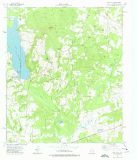
1973 Map of New Salem
USGS Topo · Published 1976About this map
Quinn Mountain rises above the transition between industrial infrastructure and the natural bottomlands of East Texas. The landscape is defined by the massive Lake Striker, where a Power Plant and associated Water Tank stand near the Southern Pacific rail line. This 1973 field check captures the area at a peak of utility, with a dense network of pipelines cutting across the terrain toward the Angelina River.
Find a feature on this map
43 named features on this map. Tap any name to fly to it.
Don’t see what you’re looking for? This feature index may not catch every label — zoom into the map to look around manually.
Map Details
Editions of this 1973 New Salem Map
This is the sole edition of this map. No revisions or reprints were ever made.
Other maps of this area

1935 · Henderson
USGS Topo · 1:48,000

1937 · Troupe
USGS Topo · 1:48,000

1939 · Henderson
USGS Topo · 1:62,500

1943 · Troup
USGS Topo · 1:62,500

1943 · Cushing
USGS Topo · 1:62,500

1943 · Rusk
USGS Topo · 1:62,500

1945 · Cushing
USGS Topo · 1:62,500

1945 · Rusk
USGS Topo · 1:62,500

1953 · Palestine
USGS Topo · 1:250,000

1956 · Tyler
USGS Topo · 1:250,000