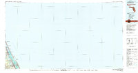
1978 Map of New Smyrna Beach
USGS Topo · Published 1980About this map
The Halifax River and the Intracostal Waterway define the coastal geography of this 1970s Volusia County survey, tracing a narrow corridor of developed barrier islands and shoreline communities. Significant urban centers like Daytona Beach and South Daytona are shown alongside smaller residential pockets such as Allandale, Wilbur-by-the-Sea, and Harbor Oaks. The coastal landscape is punctuated by the Ponce de Leon Inlet, where the U.S. Coast Guard Reservation stands watch near a prominent Lookout.
Find a feature on this map
23 named features on this map. Tap any name to fly to it.
Don’t see what you’re looking for? This feature index may not catch every label — zoom into the map to look around manually.
Map Details
Editions of this 1978 New Smyrna Beach Map
2 editions found

Other maps of this area

1927 · Matanzas
USGS Topo · 1:48,000

1937 · Port Orange
USGS Topo · 1:48,000

1937 · Ormond
USGS Topo · 1:48,000

1943 · Matanzas
USGS Topo · 1:62,500

1943 · Port Orange
USGS Topo · 1:62,500

1944 · Ormond
USGS Topo · 1:62,500

1944 · Matanzas
USGS Topo · 1:62,500

1944 · Port Orange
USGS Topo · 1:62,500

1950 · Ariel
USGS Topo · 1:24,000

1950 · Edgewater
USGS Topo · 1:24,000