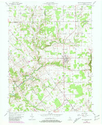
1956 Map of New Washington
USGS Topo · Published 1981About this map
The Clark Military Grant defines much of the land organization in this section of Clark County, with its distinctive diagonal survey lines contrasting against the standard township grids. The settlement of New Washington serves as a central hub, while smaller communities like New Market and Hibernia are located near the winding waters of Fourteenmile Creek. This waterway, along with its West Fork and East Fork, carves a deep path through the landscape, influencing the placement of early roads and homesteads.
Find a feature on this map
24 named features on this map. Tap any name to fly to it.
Don’t see what you’re looking for? This feature index may not catch every label — zoom into the map to look around manually.
Map Details
Editions of this 1956 New Washington Map
4 editions found
Other maps of this area

1905 · Prospect
USGS Topo · 1:62,500

1912 · Prospect
USGS Topo · 1:62,500

1932 · La Grange
USGS Topo · 1:62,500

1937 · Charlestown
USGS Topo · 1:24,000

1938 · Owen
USGS Topo · 1:24,000

1939 · Bethlehem
USGS Topo · 1:24,000

1939 · Madison West
USGS Topo · 1:24,000

1948 · Bethlehem
USGS Topo · 1:24,000

1948 · Madison West
USGS Topo · 1:24,000

1948 · Owen
USGS Topo · 1:24,000