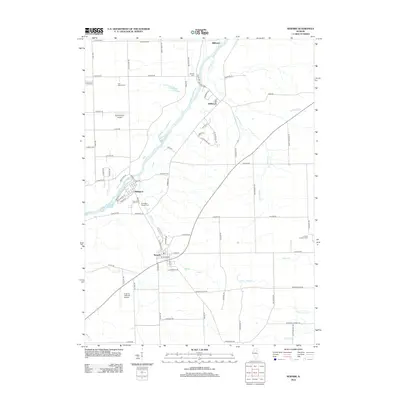
2012 Map of Newark
USGS Topo · Published 2012About this map
The Fox River winds through the northern half of this Kendall County landscape, anchoring several riverside communities that grew out of early nineteenth-century milling and river trade. Millington sits directly on the banks, showing its traditional street grid near the water, while Newark serves as a more central hub to the south. The terrain is defined by the intersection of water and roadway, with Millbrook and Millhurst positioned further north along the river's path. These settlements reflect a long-standing agricultural and industrial heritage that persists through modern road networks. Genealogists and local historians can trace the relationship between these town sites and the surrounding prairie drainage systems, which have shaped the development of this Illinois corridor for generations.
Find a feature on this map
4 named features on this map. Tap any name to fly to it.
Don’t see what you’re looking for? This feature index may not catch every label — zoom into the map to look around manually.
Map Details
Editions of this 2012 Newark Map
This is the sole edition of this map. No revisions or reprints were ever made.
Other maps of this area

1892 · Morris
USGS Topo · 1:62,500

1892 · Marseilles
USGS Topo · 1:62,500

1916 · Marseilles
USGS Topo · 1:62,500

1918 · Morris
USGS Topo · 1:62,500

1925 · Yorkville
USGS Topo · 1:62,500

1940 · Marseilles
USGS Topo · 1:62,500

1948 · Sandwich
USGS Topo · 1:62,500

1950 · Sandwich
USGS Topo · 1:62,500

1953 · Plattville
USGS Topo · 1:24,000

1953 · Lisbon
USGS Topo · 1:24,000