
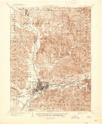
1909 Map of Newark
USGS Topo · Published 1937About this map
The confluence of the North Fork Licking River, Raccoon Creek, and South Fork Licking River anchors this study of central Ohio's landscape. Newark serves as the industrial and transportation hub, displaying a dense street grid alongside Cedar Hill Cem and significant earthworks like the Indian Mounds. The region's early 20th-century character is defined by a heavy reliance on rail, with the Baltimore and Ohio RR and the Electric RR lines threading through the valley.
Find a feature on this map
95 named features on this map. Tap any name to fly to it.
Don’t see what you’re looking for? This feature index may not catch every label — zoom into the map to look around manually.
Map Details
Editions of this 1909 Newark Map
2 editions found
Other maps of this area

1907 · Thurston
USGS Topo · 1:62,500

1908 · Granville
USGS Topo · 1:62,500

1909 · Thornville
USGS Topo · 1:62,500

1909 · Thurston
USGS Topo · 1:62,500

1910 · Frazeysburg
USGS Topo · 1:62,500

1910 · Zanesville
USGS Topo · 1:62,500

1910 · Granville
USGS Topo · 1:62,500

1912 · Gambier
USGS Topo · 1:62,500

1913 · Brinkhaven
USGS Topo · 1:62,500

1914 · Gambier
USGS Topo · 1:62,500