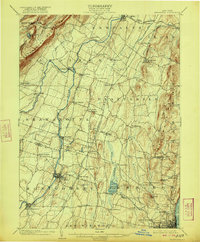
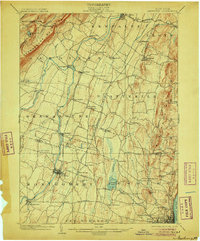
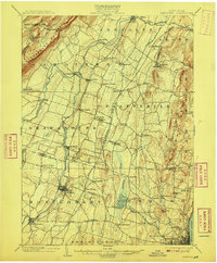
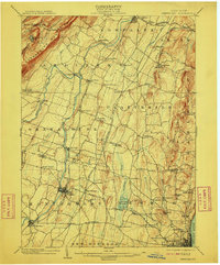
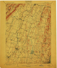
1903 Map of Newburgh
USGS Topo · Published 1922About this map
The Shawangunk Mountains rise prominently in the northwest corner of this turn-of-the-century Hudson Valley landscape, overlooking a complex network of water and rail transport. The Wallkill River serves as a central artery, flanked by the Wallkill Valley Branch and settlements like Walden and Montgomery. Industrial and utility infrastructure of the era is evident through the presence of the Powder Works near the Hudson River and the sweeping paths of the Catskill Aqueduct and New England Aqueduct as they traverse the countryside. To the east, the landscape transitions toward Newburgh and Orange Lake, where the Newburgh Electric Ry. connected the regional population centers. This map captures the region before modern suburbanization, documenting numerous small hamlets such as Ireland Corners, St. Andrew, and New Hurley that defined the early 20th-century character of Ulster and Orange counties.
Find a feature on this map
81 named features on this map. Tap any name to fly to it.
Don’t see what you’re looking for? This feature index may not catch every label — zoom into the map to look around manually.
Map Details
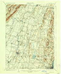
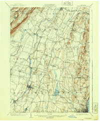
Editions of this 1903 Newburgh Map
10 editions found

1903 edition
16.6 x 20.1 inches
1906 edition
16.6 x 20.1 inches
1908 edition
16.6 x 20.1 inches
1910 edition
16.6 x 20.1 inches
1913 edition
16.6 x 19.9 inches
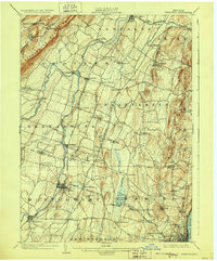
1922 edition
16.4 x 19.8 inches
1928 edition
16.6 x 20.1 inches
1936 edition
16.6 x 20.1 inches
1943 edition
16.6 x 20.1 inches

1948 edition
17.1 x 20.9 inches
Other maps of this area

1892 · West Point
USGS Topo · 1:62,500

1893 · Poughkeepsie
USGS Topo · 1:62,500

1894 · West Point
USGS Topo · 1:62,500

1894 · Poughkeepsie
USGS Topo · 1:62,500

1898 · Rhinebeck
USGS Topo · 1:62,500

1899 · West Point
USGS Topo · 1:62,500

1901 · West Point
USGS Topo · 1:62,500

1901 · Rosendale
USGS Topo · 1:62,500

1902 · Schunemunk
USGS Topo · 1:62,500

1903 · Poughkeepsie
USGS Topo · 1:62,500