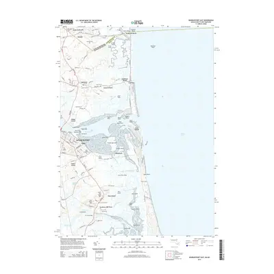
2015 Map of Newburyport East
USGS Topo · Published 2015About this map
Newburyport and its maritime surroundings are documented here at the mouth of the Merrimack River. This coastal landscape is defined by the complex transition from mainland settlements to the barrier system of Plum Island, separated by the expansive Joppa Flats and Plumbush Creek. The area’s deep colonial roots are evident in the concentration of historical sites, including the First Parish Burying Ground and Newbury Old Town.
Find a feature on this map
136 named features on this map. Tap any name to fly to it.
Don’t see what you’re looking for? This feature index may not catch every label — zoom into the map to look around manually.
Map Details
Editions of this 2015 Newburyport East Map
This is the sole edition of this map. No revisions or reprints were ever made.
Other maps of this area

1886 · Gloucester
USGS Topo · 1:62,500

1888 · Newburyport
USGS Topo · 1:62,500

1888 · Gloucester
USGS Topo · 1:62,500

1888 · Salem
USGS Topo · 1:62,500

1890 · Newburyport
USGS Topo · 1:62,500

1893 · Salem
USGS Topo · 1:62,500

1893 · Gloucester
USGS Topo · 1:62,500

1894 · Newburyport
USGS Topo · 1:62,500

1917 · Salem
USGS Topo · 1:62,500

1918 · Gloucester
USGS Topo · 1:62,500