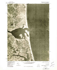
1977 Map of Newburyport East
USGS Topo · Published 1981About this map
Newburyport stands as the urban anchor of this coastal orthophotoquad, situated where the broad Merrimack River meets the sea. This unique 1970s visual survey, produced by the Geological Survey in cooperation with the Soil Conservation Service, uses rectified photoimagery to reveal the intricate saltwater marshes and tidal inlets that dominate the landscape south of the city. The transition from the developed town centers to the shifting sands of Plum Island and the meandering course of the Parker River is captured with striking clarity, showing the precise density of settlement along the shoreline.
Find a feature on this map
11 named features on this map. Tap any name to fly to it.
Don’t see what you’re looking for? This feature index may not catch every label — zoom into the map to look around manually.
Map Details
Editions of this 1977 Newburyport East Map
This is the sole edition of this map. No revisions or reprints were ever made.
Other maps of this area

1886 · Gloucester
USGS Topo · 1:62,500

1888 · Newburyport
USGS Topo · 1:62,500

1888 · Gloucester
USGS Topo · 1:62,500

1888 · Salem
USGS Topo · 1:62,500

1890 · Newburyport
USGS Topo · 1:62,500

1893 · Salem
USGS Topo · 1:62,500

1893 · Gloucester
USGS Topo · 1:62,500

1894 · Newburyport
USGS Topo · 1:62,500

1917 · Salem
USGS Topo · 1:62,500

1918 · Gloucester
USGS Topo · 1:62,500