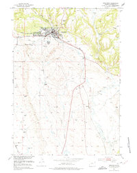
1951 Map of Newcastle
USGS Topo · Published 1975About this map
Newcastle stands as the primary hub of this eastern Wyoming landscape, where the town's industrial and civic infrastructure is mapped in detail during the early 1950s. The Chicago Burlington and Quincy railroad cuts a vital path through the terrain, connecting the settlement to broader markets and supporting local industry indicated by several oil wells and a Gravel Pit. Cultural landmarks of the era are clearly visible, including the Greenwood Cem, the local Armory, and a Drive-in Theater situated on the outskirts of town.
Find a feature on this map
21 named features on this map. Tap any name to fly to it.
Don’t see what you’re looking for? This feature index may not catch every label — zoom into the map to look around manually.
Map Details
Editions of this 1951 Newcastle Map
3 editions found
Other maps of this area

1899 · Newcastle
USGS Topo · 1:125,000

1901 · Newcastle
USGS Topo · 1:125,000

1951 · Owens
USGS Topo · 1:24,000

1951 · Newcastle
USGS Topo · 1:24,000

1951 · Morrisey NE
USGS Topo · 1:24,000

1951 · Fanny Peak
USGS Topo · 1:24,000

1951 · Osage SE
USGS Topo · 1:24,000

1951 · Clifton
USGS Topo · 1:24,000

1955 · Newcastle
USGS Topo · 1:250,000

1958 · Newcastle
USGS Topo · 1:250,000