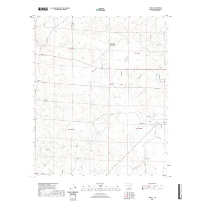
2020 Map of Newell
USGS Topo · Published 2020About this map
The South Arkansas Regional Airport at Goodwin Field serves as a prominent landmark in this Union County landscape, situated between the rural communities of Cairo and Newell. This survey is particularly valuable for genealogists due to the density of family and community burial grounds, including Mount Zion Cem, Goodwin Cem, Pate Cem, and Friendship Cem. The natural drainage of the region is defined by a complex network of creeks such as Richland Cr, Dry Cr, and Beech Cr, which flow toward the Little Cornie Bayou in the southeast. This modern update of the topography reveals how established roads like Lisbon Rd and Shuler Rd continue to connect the scattered homes and farms of the area, maintaining a settlement pattern that mirrors historical property lines and small-scale agriculture.
Find a feature on this map
62 named features on this map. Tap any name to fly to it.
Don’t see what you’re looking for? This feature index may not catch every label — zoom into the map to look around manually.
Map Details
Editions of this 2020 Newell Map
This is the sole edition of this map. No revisions or reprints were ever made.
Other maps of this area

1927 · El Dorado
USGS Topo · 1:62,500

1930 · El Dorado
USGS Topo · 1:62,500

1951 · El Dorado
USGS Topo · 1:62,500

1953 · El Dorado
USGS Topo · 1:250,000

1957 · El Dorado
USGS Topo · 1:250,000

1958 · El Dorado
USGS Topo · 1:250,000

1960 · El Dorado
USGS Topo · 1:250,000

1962 · Lisbon
USGS Topo · 1:24,000

1962 · Smackover
USGS Topo · 1:24,000

1962 · Mt Holly
USGS Topo · 1:24,000