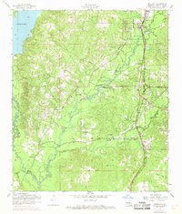
1954 Map of Newllano
USGS Topo · Published 1968About this map
Newllano and the surrounding timberlands of Vernon Parish are defined by the winding course of Bayou Castor and the vast waters of Anacoco Lake. This mid-century survey captures a landscape transitioning between agricultural roots and the influence of the Kansas City Southern railroad corridor. The area is dotted with small rural nodes like Pickering, Coopers, and Billy Goat Hill, each anchored by essential community landmarks such as the Pickering School and numerous country churches including Saint Petersburg Church and Jackson Chapel.
Find a feature on this map
32 named features on this map. Tap any name to fly to it.
Don’t see what you’re looking for? This feature index may not catch every label — zoom into the map to look around manually.
Map Details
Editions of this 1954 Newllano Map
4 editions found
Other maps of this area

1941 · Leesville
USGS Topo · 1:62,500

1941 · Slagle
USGS Topo · 1:62,500

1943 · Leesville
USGS Topo · 1:62,500

1944 · Slagle
USGS Topo · 1:62,500

1946 · Leesville
USGS Topo · 1:62,500

1947 · Rosepine
USGS Topo · 1:31,680

1947 · Knight
USGS Topo · 1:31,680

1947 · Chasmore
USGS Topo · 1:31,680

1948 · Leesville
USGS Topo · 1:62,500

1952 · Lake Charles
USGS Topo · 1:250,000