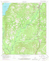
1954 Map of Newllano
USGS Topo · Published 1981About this map
Anacoco Lake dominates the northwest corner of this Vernon Parish landscape, where the waters of Bayou Anacoco and Bayou Castor converge. The topography is defined by the Kansas City Southern railroad corridor, which serves the primary settlements of Newllano and Pickering. This mid-century survey reveals a community deeply rooted in its local institutions, evidenced by a high density of rural churches and family burial grounds like the Gill Cemetery, Mt Pleasant Cemetery, and Craft Cemetery.
Find a feature on this map
36 named features on this map. Tap any name to fly to it.
Don’t see what you’re looking for? This feature index may not catch every label — zoom into the map to look around manually.
Map Details
Editions of this 1954 Newllano Map
4 editions found
Other maps of this area

1941 · Leesville
USGS Topo · 1:62,500

1941 · Slagle
USGS Topo · 1:62,500

1943 · Leesville
USGS Topo · 1:62,500

1944 · Slagle
USGS Topo · 1:62,500

1946 · Leesville
USGS Topo · 1:62,500

1947 · Rosepine
USGS Topo · 1:31,680

1947 · Knight
USGS Topo · 1:31,680

1947 · Chasmore
USGS Topo · 1:31,680

1948 · Leesville
USGS Topo · 1:62,500

1952 · Lake Charles
USGS Topo · 1:250,000