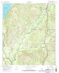
1954 Map of Newllano
USGS Topo · Published 1981About this map
Newllano and the adjacent lumber-era town of Pickering center this mid-century look at Vernon Parish, where the local economy follows the corridor of the Kansas City Southern railroad. The landscape is defined by the winding course of Bayou Castor and the broad waters of Anacoco Lake to the northwest. A distinct legacy of early industrial transport is visible in the dismantled railroad grade that cuts across the hilly terrain north of Whiteoak Church.
Find a feature on this map
33 named features on this map. Tap any name to fly to it.
Don’t see what you’re looking for? This feature index may not catch every label — zoom into the map to look around manually.
Map Details
Editions of this 1954 Newllano Map
4 editions found
Other maps of this area

1941 · Leesville
USGS Topo · 1:62,500

1941 · Slagle
USGS Topo · 1:62,500

1943 · Leesville
USGS Topo · 1:62,500

1944 · Slagle
USGS Topo · 1:62,500

1946 · Leesville
USGS Topo · 1:62,500

1947 · Rosepine
USGS Topo · 1:31,680

1947 · Knight
USGS Topo · 1:31,680

1947 · Chasmore
USGS Topo · 1:31,680

1948 · Leesville
USGS Topo · 1:62,500

1952 · Lake Charles
USGS Topo · 1:250,000