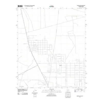
2010 Map of Newman SW
USGS Topo · Published 2010About this map
Chaparral straddles the borderlands of New Mexico and Texas, represented here in this 2010 survey by a distinctive grid of residential streets reaching toward the Franklin Mountains. The settlement pattern is defined by long, straight thoroughfares like McCombs Rd and De Lara Estates Rd, interspersed with a network of smaller drives and loops. The presence of Quirke Lake provides a central landmark amidst the desert landscape, while street names such as Hot Peppers Rd, Salsa Rd, and Buenos Dias Ct reflect the regional character. This map serves as a detailed record of the community’s layout just south of the state line, illustrating the extent of local developments like the Green River Loop and the eastern expansion toward Mesilla View Dr.
Find a feature on this map
36 named features on this map. Tap any name to fly to it.
Don’t see what you’re looking for? This feature index may not catch every label — zoom into the map to look around manually.
Map Details
Editions of this 2010 Newman SW Map
This is the sole edition of this map. No revisions or reprints were ever made.
Other maps of this area

1891 · Las Cruces
USGS Topo · 1:125,000

1893 · Las Cruces
USGS Topo · 1:125,000

1896 · El Paso
USGS Topo · 1:125,000

1908 · El Paso
USGS Topo · 1:125,000

1917 · Canutillo
USGS Topo · 1:62,500

1919 · Canutillo
USGS Topo · 1:62,500

1940 · Newman
USGS Topo · 1:62,500

1942 · Fort Bliss
USGS Topo · 1:62,500

1943 · La Mesa
USGS Topo · 1:62,500

1943 · Newman
USGS Topo · 1:62,500