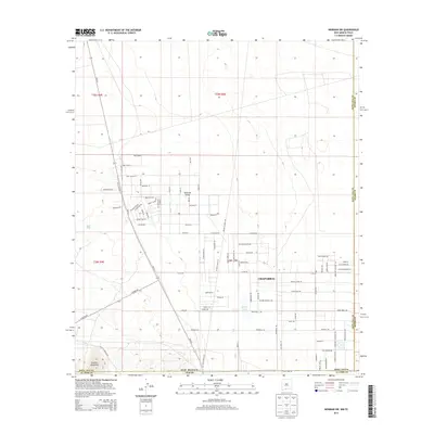
2013 Map of Newman SW
USGS Topo · Published 2013About this map
Chaparral straddles the border of New Mexico and Texas, spreading across the desert floor of the Tularosa Valley. In 2013, the community’s grid-like expansion is clearly defined against the backdrop of the Franklin Mountains to the southwest. This landscape is a patchwork of residential development and arid terrain, characterized by a complex network of local roads such as Nike Air Rd, Rim Rock Rd, and Paseo Real Dr. The map provides a look at local hydrology and infrastructure in this borderland, featuring isolated water points like Sand Tank and Quirke Lake. Notable for genealogists and local historians, the sheet identifies specific street names and land divisions that mark the growth of this desert settlement, including Hermosa Dr and Oasis Dr, situated near the intersection of NM-213 and the state line.
Find a feature on this map
48 named features on this map. Tap any name to fly to it.
Don’t see what you’re looking for? This feature index may not catch every label — zoom into the map to look around manually.
Map Details
Editions of this 2013 Newman SW Map
This is the sole edition of this map. No revisions or reprints were ever made.
Other maps of this area

1891 · Las Cruces
USGS Topo · 1:125,000

1893 · Las Cruces
USGS Topo · 1:125,000

1896 · El Paso
USGS Topo · 1:125,000

1908 · El Paso
USGS Topo · 1:125,000

1917 · Canutillo
USGS Topo · 1:62,500

1919 · Canutillo
USGS Topo · 1:62,500

1940 · Newman
USGS Topo · 1:62,500

1942 · Fort Bliss
USGS Topo · 1:62,500

1943 · La Mesa
USGS Topo · 1:62,500

1943 · Newman
USGS Topo · 1:62,500