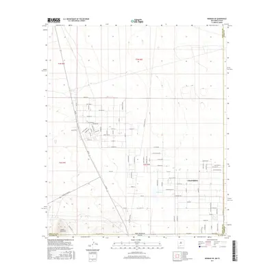
2017 Map of Newman SW
USGS Topo · Published 2017About this map
Chaparral sits at the intersection of Dona Ana and Otero counties in New Mexico, extending south to the El Paso County line in Texas. This borderlands settlement is defined by a grid of residential streets with evocative local names such as Hot Peppers Rd, Red Stone St, and Desert Aire Dr. The landscape is largely arid, marked by the presence of Sand Tank and the seasonal Quirke Lake. To the southwest, the terrain rises toward the Franklin Mountains, providing a topographical contrast to the developed blocks of the community. The inclusion of Nike Air Rd and Missile Dr suggests the historical influence of nearby military installations on the region's infrastructure and naming conventions. This 2017 survey details the expanding residential footprint as it transitions from structured neighborhoods into the open desert and mountain foothills.
Find a feature on this map
91 named features on this map. Tap any name to fly to it.
Don’t see what you’re looking for? This feature index may not catch every label — zoom into the map to look around manually.
Map Details
Editions of this 2017 Newman SW Map
This is the sole edition of this map. No revisions or reprints were ever made.
Other maps of this area

1891 · Las Cruces
USGS Topo · 1:125,000

1893 · Las Cruces
USGS Topo · 1:125,000

1896 · El Paso
USGS Topo · 1:125,000

1908 · El Paso
USGS Topo · 1:125,000

1917 · Canutillo
USGS Topo · 1:62,500

1919 · Canutillo
USGS Topo · 1:62,500

1940 · Newman
USGS Topo · 1:62,500

1942 · Fort Bliss
USGS Topo · 1:62,500

1943 · La Mesa
USGS Topo · 1:62,500

1943 · Newman
USGS Topo · 1:62,500