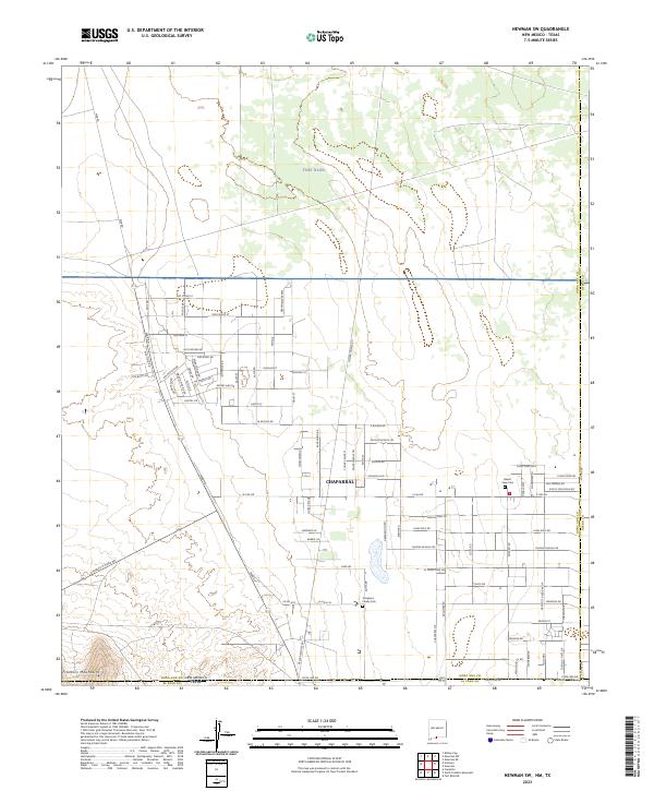
2023 Map of Newman SW
USGS Topo · Published 2023About this map
Chaparral sits at the intersection of local history and military influence along the New Mexico-Texas border. The settlement’s residential grid expands across the desert floor, evidenced by street names like Hot Peppers Rd and Hueco St that reflect regional character. To the north and east, the landscape is dominated by the sprawling presence of Fort Bliss, illustrating the significant footprint of the United States military in this arid environment.
Find a feature on this map
88 named features on this map. Tap any name to fly to it.
Don’t see what you’re looking for? This feature index may not catch every label — zoom into the map to look around manually.
Map Details
Editions of this 2023 Newman SW Map
This is the sole edition of this map. No revisions or reprints were ever made.
Other maps of this area

1891 · Las Cruces
USGS Topo · 1:125,000

1893 · Las Cruces
USGS Topo · 1:125,000

1896 · El Paso
USGS Topo · 1:125,000

1908 · El Paso
USGS Topo · 1:125,000

1917 · Canutillo
USGS Topo · 1:62,500

1919 · Canutillo
USGS Topo · 1:62,500

1940 · Newman
USGS Topo · 1:62,500

1942 · Fort Bliss
USGS Topo · 1:62,500

1943 · La Mesa
USGS Topo · 1:62,500

1943 · Newman
USGS Topo · 1:62,500