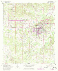
1966 Map of Newton
USGS Topo · Published 1982About this map
Newton serves as the focal point of this Mississippi landscape, where the Illinois Central Gulf railroad facilitates commerce and travel. The urban area, revised in 1982, reveals the presence of Clark Memorial College and several radio towers, including the WBKN Radio Tower, indicating the town's role as a regional communications and education hub. To the west lies the smaller settlement of Lawrence, while the southern portion of the quadrangle transitions into the wooded expanses of the Bienville National Forest near Nance Hill.
Find a feature on this map
43 named features on this map. Tap any name to fly to it.
Don’t see what you’re looking for? This feature index may not catch every label — zoom into the map to look around manually.
Map Details
Editions of this 1966 Newton Map
2 editions found
Other maps of this area

1921 · Forest
USGS Topo · 1:48,000

1922 · Forest
USGS Topo · 1:62,500

1950 · Forest
USGS Topo · 1:62,500

1952 · Forest
USGS Topo · 1:62,500

1953 · Meridian
USGS Topo · 1:250,000

1957 · Meridian
USGS Topo · 1:250,000

1965 · Meridian
USGS Topo · 1:250,000

1966 · Hickory
USGS Topo · 1:24,000

1966 · Newton
USGS Topo · 1:24,000

1966 · Decatur NW
USGS Topo · 1:24,000