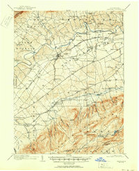
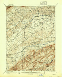
1919 Map of Newville
USGS Topo · Published 1951About this map
Newville serves as the primary hub of this Cumberland Valley landscape, situated along the Conodoguinet Creek and the Cumberland Valley RR. The map captures an era of agrarian industry and rural community structure, characterized by a dense network of country schools like the State Road School and Quarry Point School. Milling operations are prominent along the waterways, with Reiters Mill and Greiders Mill indicating the continued importance of local grain processing. To the south, the terrain rises sharply into the ridges of South Mountain, where the industrial heritage of the region is anchored by Pine Grove Furnace. This area is also a nexus for early transportation, featuring the Philadelphia and Reading RR and various crossroads settlements such as Walnut Bottom and Lees Crossroads, which supported the local traveling public and regional trade.
Find a feature on this map
127 named features on this map. Tap any name to fly to it.
Don’t see what you’re looking for? This feature index may not catch every label — zoom into the map to look around manually.
Map Details
Editions of this 1919 Newville Map
6 editions found
Other maps of this area

1902 · Chambersburg
USGS Topo · 1:62,500

1904 · Carlisle
USGS Topo · 1:62,500

1907 · New Bloomfield
USGS Topo · 1:62,500

1908 · Gettysburg
USGS Topo · 1:62,500

1909 · Fairfield
USGS Topo · 1:62,500

1919 · Newville
USGS Topo · 1:62,500

1919 · Mattawana
USGS Topo · 1:62,500

1923 · Shippensburg
USGS Topo · 1:62,500

1930 · Loysville
USGS Topo · 1:62,500

1933 · Loysville
USGS Topo · 1:62,500
Featured Places
- Shippensburg, PA
- Dickinson, Penn Township
- Plainfield, West Pennsboro Township
- Southampton Township, PA
- North Newton Township, PA