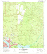
1970 Map of Niceville
USGS Topo · Published 1972About this map
The coastal landscapes of Niceville and Valparaiso are defined by the winding waters of Boggy Bayou, Rocky Bayou, and Toms Bayou. At the dawn of the 1970s, this area reflects a significant military and educational footprint, dominated by the sprawling Eglin Air Force Base and its Aux Field No 2. The presence of Okaloosa-Walton Jr College and schools like Ruckel Jr High Sch highlights the mid-century growth of these communities along the Coastal Hwy.
Find a feature on this map
58 named features on this map. Tap any name to fly to it.
Don’t see what you’re looking for? This feature index may not catch every label — zoom into the map to look around manually.
Map Details
Editions of this 1970 Niceville Map
4 editions found
Other maps of this area

1934 · Holt
USGS Topo · 1:48,000

1934 · Niceville
USGS Topo · 1:48,000

1935 · Villa Tasso
USGS Topo · 1:48,000

1936 · Niceville
USGS Topo · 1:62,500

1937 · Holt
USGS Topo · 1:62,500

1938 · Mary Esther
USGS Topo · 1:62,500

1938 · Villa Tasso
USGS Topo · 1:62,500

1956 · Niceville
USGS Topo · 1:62,500

1956 · Fort Walton Beach
USGS Topo · 1:62,500

1956 · Holt
USGS Topo · 1:62,500