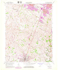
1965 Map of Nicholasville
USGS Topo · Published 1979About this map
Nicholasville serves as the focal point in this Central Kentucky survey, where the Southern railroad line cuts through the heart of the settlement. The landscape transitions from the urbanized southern edge of Lexington, featuring mid-century developments like Lansdowne and Stoneybrook, into the fertile agricultural terrain of Jessamine County. Significant local landmarks include the Waveland Museum and the Blue Grass Raceway, highlighting a mix of cultural heritage and modern recreation during this period of suburban expansion.
Find a feature on this map
47 named features on this map. Tap any name to fly to it.
Don’t see what you’re looking for? This feature index may not catch every label — zoom into the map to look around manually.
Map Details
Editions of this 1965 Nicholasville Map
4 editions found
Other maps of this area

1892 · Richmond
USGS Topo · 1:125,000

1897 · Richmond
USGS Topo · 1:125,000

1905 · Harrodsburg
USGS Topo · 1:125,000

1906 · Georgetown
USGS Topo · 1:62,500

1908 · Georgetown
USGS Topo · 1:62,500

1927 · Lexington
USGS Topo · 1:48,000

1929 · Lexington
USGS Topo · 1:62,500

1950 · Lexington East
USGS Topo · 1:24,000

1950 · Lexington West
USGS Topo · 1:24,000

1952 · Keene
USGS Topo · 1:24,000