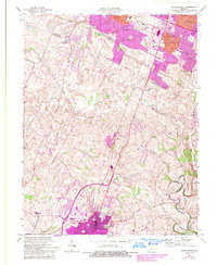
1965 Map of Nicholasville
USGS Topo · Published 1993About this map
Nicholasville anchors this mid-century look at central Kentucky, where the expanding urban footprint of Lexington meets the rural landscapes of Jessamine County. The transition from town to country is marked by emerging developments like Stonewall Estates, Brigadoon, and Blueberry Hill along the northern boundary. Farther south, the terrain descends toward the Hickman Creek drainage and the small settlement at Union Mills.
Find a feature on this map
41 named features on this map. Tap any name to fly to it.
Don’t see what you’re looking for? This feature index may not catch every label — zoom into the map to look around manually.
Map Details
Editions of this 1965 Nicholasville Map
4 editions found
Other maps of this area

1892 · Richmond
USGS Topo · 1:125,000

1897 · Richmond
USGS Topo · 1:125,000

1905 · Harrodsburg
USGS Topo · 1:125,000

1906 · Georgetown
USGS Topo · 1:62,500

1908 · Georgetown
USGS Topo · 1:62,500

1927 · Lexington
USGS Topo · 1:48,000

1929 · Lexington
USGS Topo · 1:62,500

1950 · Lexington East
USGS Topo · 1:24,000

1950 · Lexington West
USGS Topo · 1:24,000

1952 · Keene
USGS Topo · 1:24,000