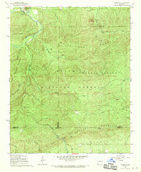
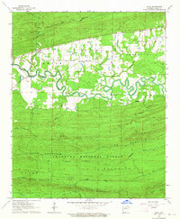
1968 Map of Nimrod SE
USGS Topo · Published 1970About this map
Ouachita National Forest dominates this topographic study, revealing the complex drainage systems and elevations that define the borders of Perry, Saline, and Garland counties. The northern reaches are characterized by the winding path of the La Fave River, which passes near the small community of Hollis and the distinct landmark of Goat Bluff. Public access points from the late 1960s are visible at the South Fourche Roadside Park and the Iron Spring Roadside Park further south.
Find a feature on this map
43 named features on this map. Tap any name to fly to it.
Don’t see what you’re looking for? This feature index may not catch every label — zoom into the map to look around manually.
Map Details
Editions of this 1968 Nimrod SE Map
4 editions found
Other maps of this area

1890 · Benton
USGS Topo · 1:125,000

1890 · Hot Springs
USGS Topo · 1:125,000

1894 · Hot Springs
USGS Topo · 1:125,000

1894 · Benton
USGS Topo · 1:125,000

1955 · Little Rock
USGS Topo · 1:250,000

1956 · Little Rock
USGS Topo · 1:250,000

1960 · Little Rock
USGS Topo · 1:250,000

1963 · Paron SW
USGS Topo · 1:24,000
1963 · Aplin
USGS Topo · 1:24,000

1964 · Little Rock
USGS Topo · 1:250,000