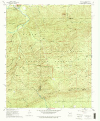
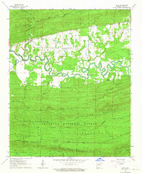
1968 Map of Nimrod SE
USGS Topo · Published 1978About this map
Hollis sits along the northern edge of this terrain, tucked near the Fourche La Fave River where the South Fourche Roadside Park marks the roadside landscape of the late 1960s. This portion of the Ouachita National Forest is defined by a series of prominent ridges, including White Oak Mountain, Walnut Bottom Mountain, and Bear Creek Mountain. Local history is anchored by the Goat Bluff Cem near the river and the Forked Mountain Cem to the east.
Find a feature on this map
41 named features on this map. Tap any name to fly to it.
Don’t see what you’re looking for? This feature index may not catch every label — zoom into the map to look around manually.
Map Details
Editions of this 1968 Nimrod SE Map
4 editions found
Other maps of this area

1890 · Benton
USGS Topo · 1:125,000

1890 · Hot Springs
USGS Topo · 1:125,000

1894 · Hot Springs
USGS Topo · 1:125,000

1894 · Benton
USGS Topo · 1:125,000

1955 · Little Rock
USGS Topo · 1:250,000

1956 · Little Rock
USGS Topo · 1:250,000

1960 · Little Rock
USGS Topo · 1:250,000

1963 · Paron SW
USGS Topo · 1:24,000
1963 · Aplin
USGS Topo · 1:24,000

1964 · Little Rock
USGS Topo · 1:250,000