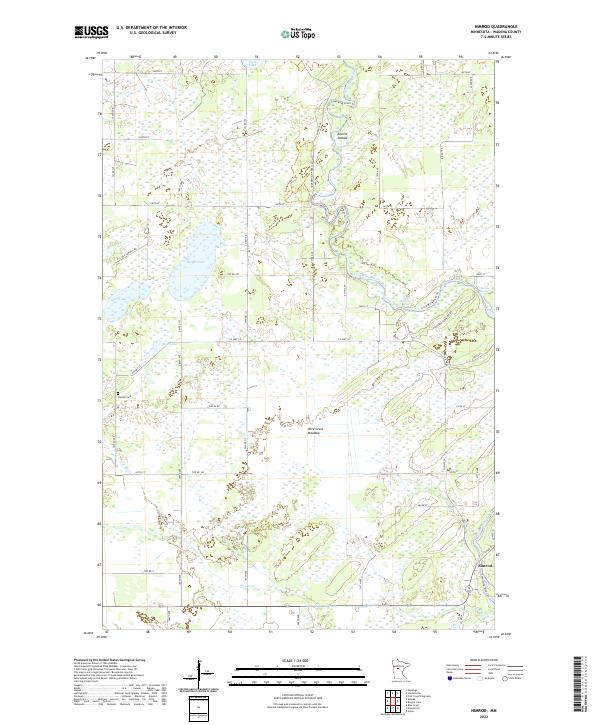
2022 Map of Nimrod
USGS Topo · Published 2022About this map
The Crow Wing River winds through this portion of Wadena County, defining a landscape of complex waterways and expansive wetlands. Near the settlement of Nimrod, the river's path is marked by features like Butterfield Rapids and Watkins Rapids, as well as the distinct Kossila Oxbow. The presence of the Finnish Cem near Rice Lake reflects the heritage of the early families who settled this region of Minnesota. Much of the terrain is dominated by low-lying areas such as Wire Grass Meadow and various basins like Yaeger Lake and Mud Lake. The road network, including the Huntersville Trl and Old Sawmill Rd, highlights the historical ties to the timber industry and the rural connectivity between the Cat River drainage and the larger Crow Wing system.
Find a feature on this map
57 named features on this map. Tap any name to fly to it.
Don’t see what you’re looking for? This feature index may not catch every label — zoom into the map to look around manually.
Map Details
Editions of this 2022 Nimrod Map
This is the sole edition of this map. No revisions or reprints were ever made.
Other maps of this area

1953 · Brainerd
USGS Topo · 1:250,000

1957 · Brainerd
USGS Topo · 1:250,000

1958 · Brainerd
USGS Topo · 1:250,000

1965 · Brainerd
USGS Topo · 1:250,000

1969 · Menahga
USGS Topo · 1:24,000

1969 · Sebeka
USGS Topo · 1:24,000
1969 · Blue Grass
USGS Topo · 1:24,000
1969 · Nimrod SW
USGS Topo · 1:24,000
1969 · Nimrod
USGS Topo · 1:24,000

1969 · Burgen Lake
USGS Topo · 1:24,000