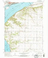
1964 Map of Niota
USGS Topo · Published 1965About this map
The Mississippi River separates the industrial activity of Fort Madison from the agrarian landscape of Appanoose and Sonora townships. A Toll Bridge and the Chicago Atchison Topeka and Santa Fe railroad bridge serve as vital links across the water, connecting the urban Iowa shore to the Illinois settlements of Niota and Old Niota. The terrain is defined by dramatic bluffs and drainage patterns from Tyson Creek and Robinson Creek that cut through the loess hills.
Find a feature on this map
33 named features on this map. Tap any name to fly to it.
Don’t see what you’re looking for? This feature index may not catch every label — zoom into the map to look around manually.
Map Details
Editions of this 1964 Niota Map
2 editions found
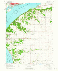
Other maps of this area

1932 · Lomax
USGS Topo · 1:62,500

1933 · Carthage
USGS Topo · 1:62,500

1936 · Keokuk
USGS Topo · 1:62,500

1936 · Fort Madison
USGS Topo · 1:62,500

1937 · Carthage
USGS Topo · 1:62,500

1937 · Lomax
USGS Topo · 1:62,500

1950 · Keokuk
USGS Topo · 1:62,500

1958 · Burlington
USGS Topo · 1:250,000

1961 · Burlington
USGS Topo · 1:250,000

1963 · Burlington
USGS Topo · 1:250,000