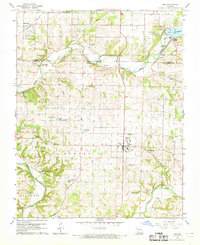
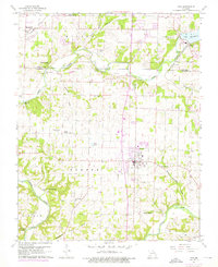
1960 Map of Nixa
USGS Topo · Published 1969About this map
The James River and Finley Creek converge within this Ozark landscape, shaping the development of Nixa and Battlefield during the mid-twentieth century. The map illustrates a rural society organized around small crossroads and family landmarks, featuring several community hubs such as Union Chapel, Union Hill Ch, and Walnut Hill Ch. Civil engineering of the era is evident at the Power Plant near Lake Springfield, while the natural topography is marked by distinctive karst features like Avin Sink and Shell Cave.
Find a feature on this map
44 named features on this map. Tap any name to fly to it.
Don’t see what you’re looking for? This feature index may not catch every label — zoom into the map to look around manually.
Map Details
Editions of this 1960 Nixa Map
5 editions found
Other maps of this area

1884 · Springfield
USGS Topo · 1:125,000

1886 · Springfield
USGS Topo · 1:125,000

1907 · Forsyth
USGS Topo · 1:125,000

1935 · Springfield
USGS Topo · 1:24,000

1936 · Brookline
USGS Topo · 1:24,000

1937 · Galloway
USGS Topo · 1:24,000

1937 · Ozark
USGS Topo · 1:48,000

1943 · Ozark
USGS Topo · 1:62,500

1945 · Harrison
USGS Topo · 1:250,000

1945 · Ozark
USGS Topo · 1:62,500