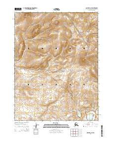
2015 Map of Noatak B-3 NW
USGS Topo · Published 2015About this map
Cape Krusenstern National Monument occupies a significant portion of this Arctic landscape, representing a protected area of immense archaeological and cultural importance in the Northwest Arctic Borough. The terrain is defined by the Alutunitok Hills, which rise to the north, providing a stark topographical contrast to the lower-lying drainage basins. The map documents the winding path of Jade Cr, a watercourse that cuts through the southwestern section of the quadrangle. The lack of road infrastructure and human settlements highlights the wilderness character of this region, governed by the Public Land Survey System divisions of t24n r22w, t24n r21w, t23n r22w, and t23n r21w. These surveyed boundaries emphasize the administrative organization of this remote territory within the larger Alaskan frontier.
Find a feature on this map
7 named features on this map. Tap any name to fly to it.
Don’t see what you’re looking for? This feature index may not catch every label — zoom into the map to look around manually.
Map Details
Editions of this 2015 Noatak B-3 NW Map
This is the sole edition of this map. No revisions or reprints were ever made.
Other maps of this area

1951 · Noatak
USGS Topo · 1:250,000

1955 · Noatak
USGS Topo · 1:250,000

1955 · Noatak B-3
USGS Topo · 1:63,360

1955 · Noatak C-4
USGS Topo · 1:63,360

1955 · Noatak C-3
USGS Topo · 1:63,360

1955 · Noatak B-4
USGS Topo · 1:63,360

1964 · Noatak
USGS Topo · 1:250,000
2014 · Noatak C-4 SE
USGS Topo · 1:25,000
2014 · Noatak B-4 SE
USGS Topo · 1:25,000
2014 · Noatak B-4 NE
USGS Topo · 1:25,000