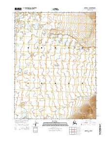
2015 Map of Noatak C-1 NW
USGS Topo · Published 2015About this map
Noatak National Preserve encompasses the entirety of this Arctic landscape, where the shifting waters of the Eli River meander across a broad, low-lying drainage basin. The terrain is defined by complex hydrological patterns, notably where Uvgoon Cr joins the larger network of streams flowing through the western portion of the preserve. This 2015 survey illustrates a wilderness nearly devoid of human infrastructure, focusing instead on the precise boundary lines of the Public Land Survey System, including t27n r17w and t26n r16w. The map provides a detailed look at the braided nature of Arctic waterways before they reach the higher elevations visible in the southeastern corner, offering a clear record of the region's natural geography in the early 21st century.
Find a feature on this map
7 named features on this map. Tap any name to fly to it.
Don’t see what you’re looking for? This feature index may not catch every label — zoom into the map to look around manually.
Map Details
Editions of this 2015 Noatak C-1 NW Map
This is the sole edition of this map. No revisions or reprints were ever made.
Other maps of this area

1951 · Noatak
USGS Topo · 1:250,000

1955 · Noatak
USGS Topo · 1:250,000

1955 · Noatak D-1
USGS Topo · 1:63,360

1955 · Noatak D-2
USGS Topo · 1:63,360

1955 · Noatak C-2
USGS Topo · 1:63,360

1955 · Noatak C-1
USGS Topo · 1:63,360

1964 · Noatak
USGS Topo · 1:250,000
2015 · Noatak C-1 SW
USGS Topo · 1:25,000
2015 · Noatak C-1 NE
USGS Topo · 1:25,000
2015 · Noatak C-2 NE
USGS Topo · 1:25,000