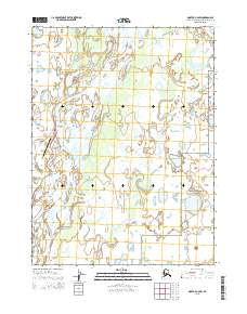
2015 Map of Noatak C-2 SW
USGS Topo · Published 2015About this map
The settlement of Noatak sits at a critical bend where the Noatak River broadens into an intricate network of gravel bars and braided channels. This 2015 survey captures the village layout, showing the primary thoroughfares of Main Street and Willow Street near the Noatak Airport, which serves as the essential transportation link for this Arctic community. To the east, the landscape transitions into the protected wilderness of the Noatak National Preserve. The hydrology of the region is defined by the confluence of major tributaries, including the Eli River, Kiyak Cr, and Kuchak Cr, which carve through the tundra before joining the main river system. The map illustrates a high-latitude environment where human habitation is concentrated along the riverbanks, surrounded by vast stretches of preserve land and seasonal watercourses.
Find a feature on this map
15 named features on this map. Tap any name to fly to it.
Don’t see what you’re looking for? This feature index may not catch every label — zoom into the map to look around manually.
Map Details
Editions of this 2015 Noatak C-2 SW Map
This is the sole edition of this map. No revisions or reprints were ever made.
Other maps of this area

1951 · Noatak
USGS Topo · 1:250,000

1955 · Noatak
USGS Topo · 1:250,000

1955 · Noatak C-2
USGS Topo · 1:63,360

1955 · Noatak B-3
USGS Topo · 1:63,360

1955 · Noatak C-3
USGS Topo · 1:63,360

1955 · Noatak B-2
USGS Topo · 1:63,360

1964 · Noatak
USGS Topo · 1:250,000
2014 · Noatak C-3 NE
USGS Topo · 1:25,000
2015 · Noatak C-2 NE
USGS Topo · 1:25,000
2015 · Noatak C-3 SE
USGS Topo · 1:25,000